Kuzikus Mapping Project (KMP)
Mapping the Kalahari ecosystem in unprecedented detail (3 cm resolution) at scale (10 000ha) over the past 9 years.
Our main aim of the Kuzikus Mapping Project is to build a biodiversity-based, digital innovation resource that helps preserve local and similar ecosystems in a future nature-conscious global economy.
Designed to bring income to the local guardians of biodiversity assets it will finally attach a tangible value to every aspect of our natural heritage.
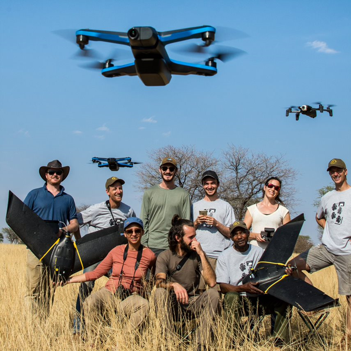
The Kuzikus Mapping Project (KMP) is a long-term drone mapping project of Kuzikus Wildlife Reserve (KWR). KMP was founded in 2014 with funding from EPFL, Drones4Earth, and KWR under the mission name “SAVMAP” to develop a monitoring tool for both sustainable land-use management and biodiversity conservation in semi-arid savanna in Namibia. To achieve this goal, KMP produces high-resolution, ecosystem feature-annotated aerial maps of KWR and neighbouring areas. KMP relies on mission-based and/or continuous partnerships with a heterogenous group of funding organisations, drone and computer vision experts, researchers, local ecologists and rangers
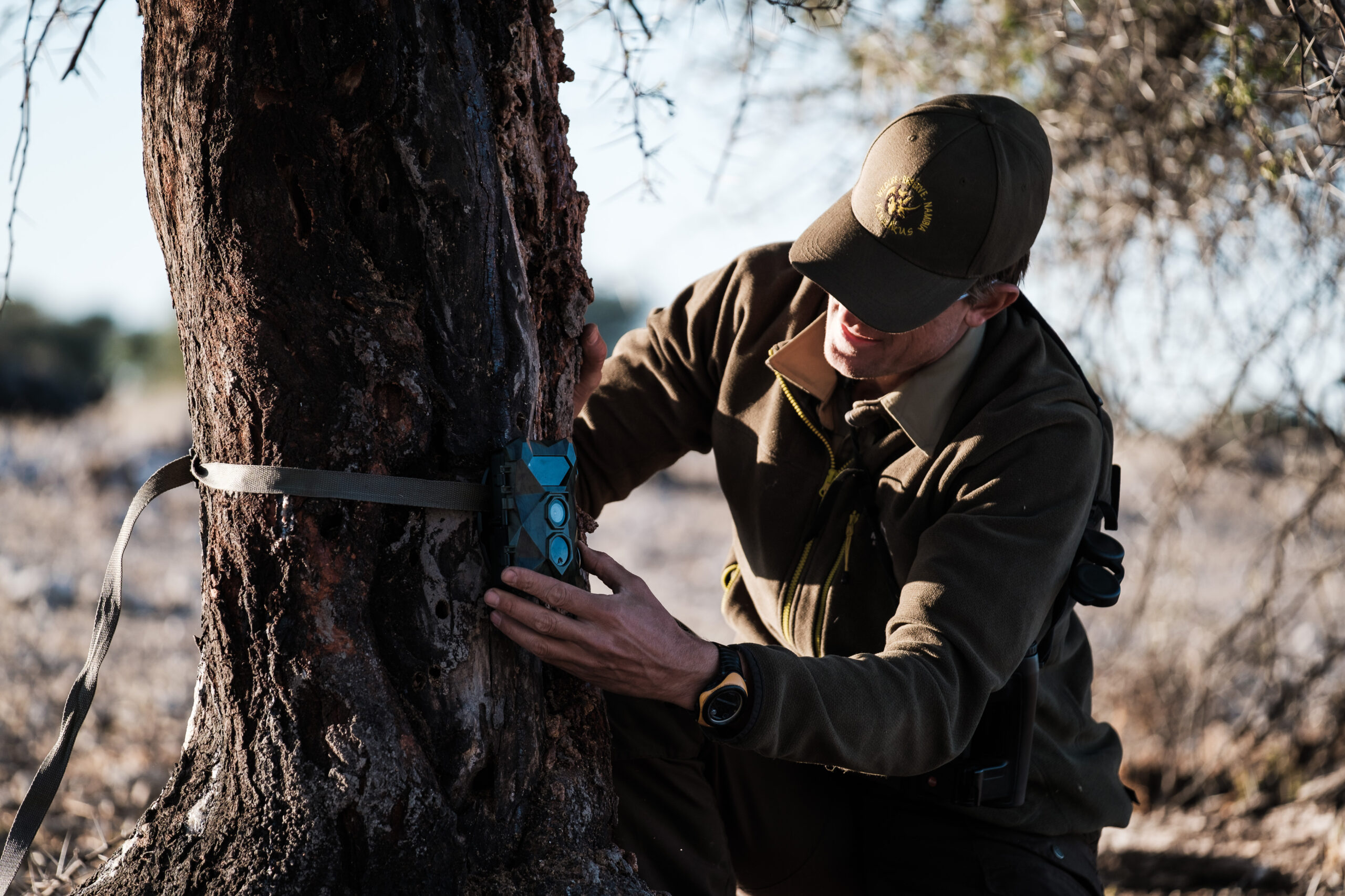
WildDrone Project
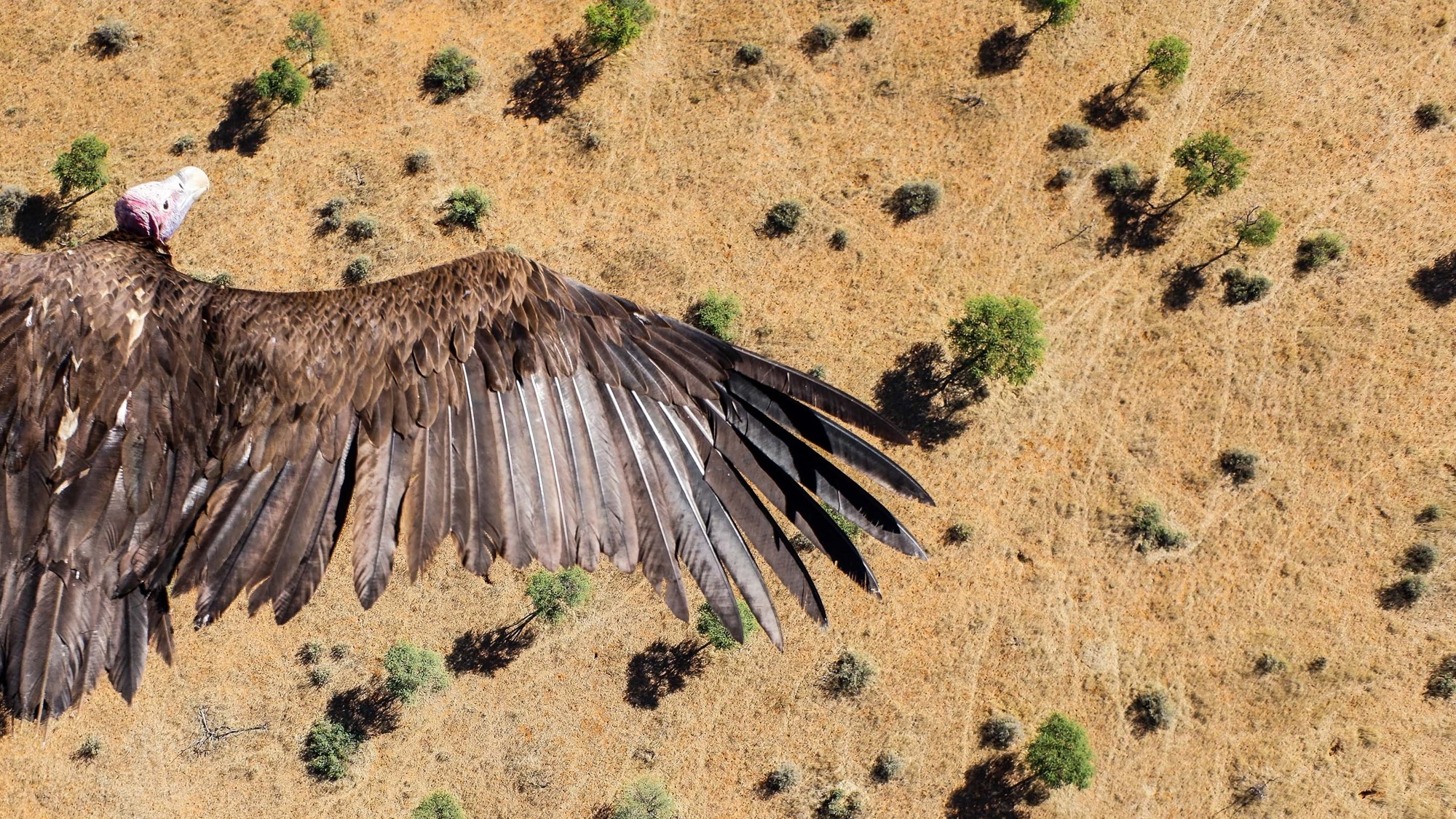
By bringing the tech-world into nature conservation, we aspire to demonstrate innovative, field-tested, technological solutions that will revolutionise our ability to safeguard, restore and overlook African wildlife.
As conservation professionals ourselves, working with securing the future of Black Rhinos on a daily basis, we are extremely excited to see technology emerging that will support rangers and local biodiversity guardians on the ground in a way never deemed possible.
Analysing drone captured images with state-of-the-art computer vision algorithms to create a quick, up to date and detailed inventory of every plant and animal within a given Nature Reserve can be a game changer in managing African wildlife populations.
Our endeavour in the field has made us an associate member of the EU WildDrone Project funded by the Marie Sklodowska Curie Actions.
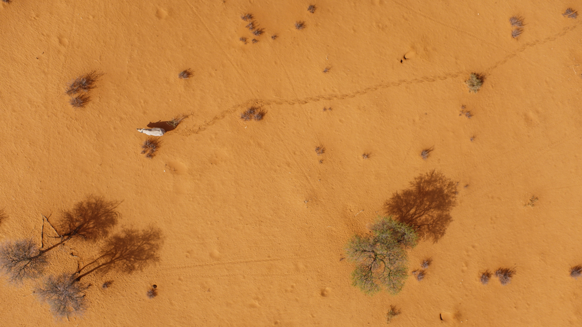
WildTrack
Footprint identification technology (FIT) as a non-invasive monitoring tool for rhinos
As members of the WildTrack Specialist group we are applying and improving the footprint identification technique (FIT) for Black Rhino. FIT will help us identify individual rhino, their sex and age-class using measurements taken from anatomical points (‘landmark points’) on the footprint.
The aim is to develop a FIT software for Black Rhino which is robust and applicable by all members of the Black Rhino Custodianship Programme of Namibia.
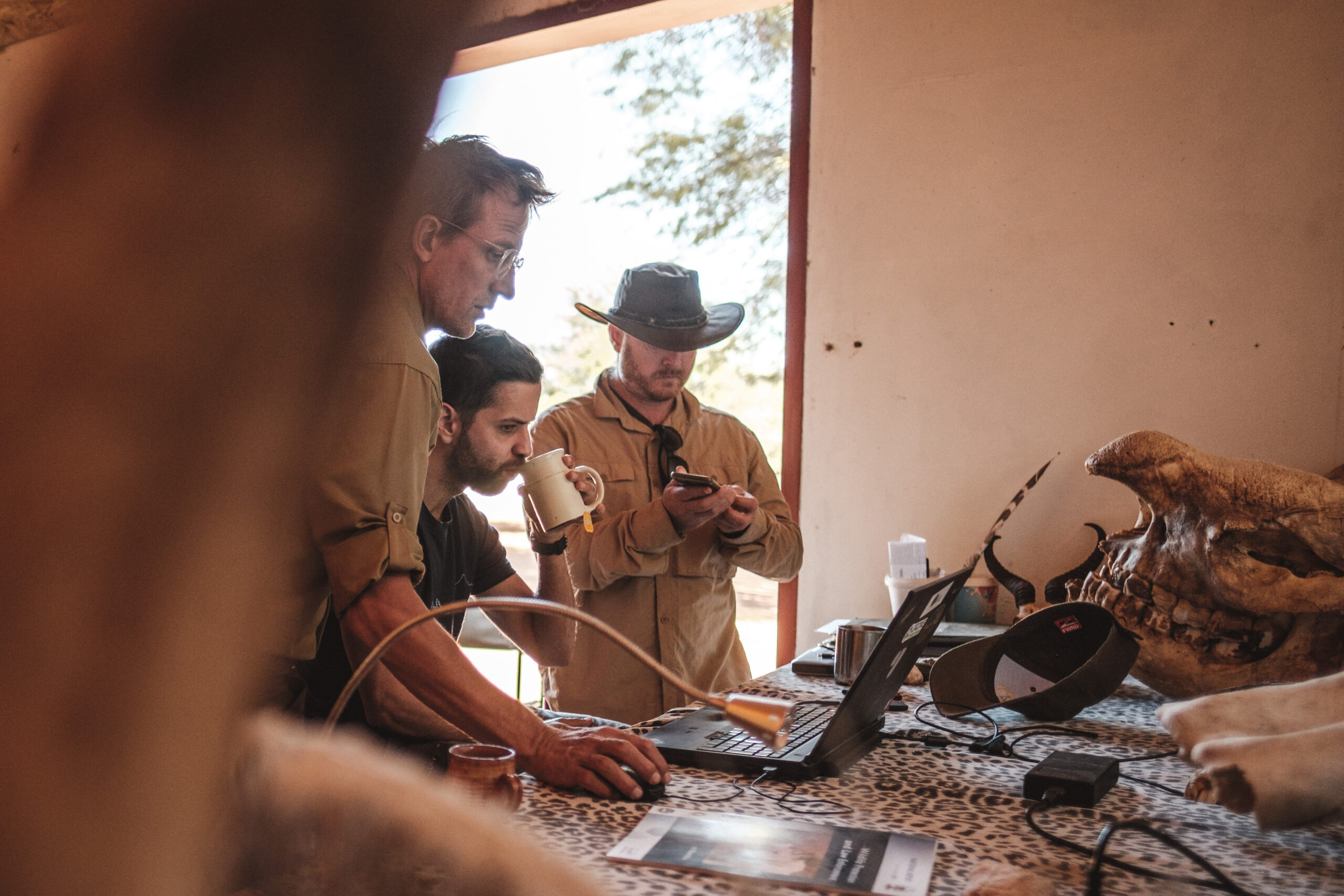
Independent Research Projects
Postgraduate students, senior researchers or Institutions are always welcome to carry out research on Kuzikus Wildlife Reserve.
However, all projects undertaken should aim to contribute to the overall aims and objectives of Kuzikus, and to the future research and development goals of Kuzikus Wildlife Reserve.
Feel free to contact us for any Research opportunities or Partnerships.